First of all, thank you for providing an excellent dataset for geospatial analysis.
I have a question which may seem very simple, yet I still struggle finding a solution.
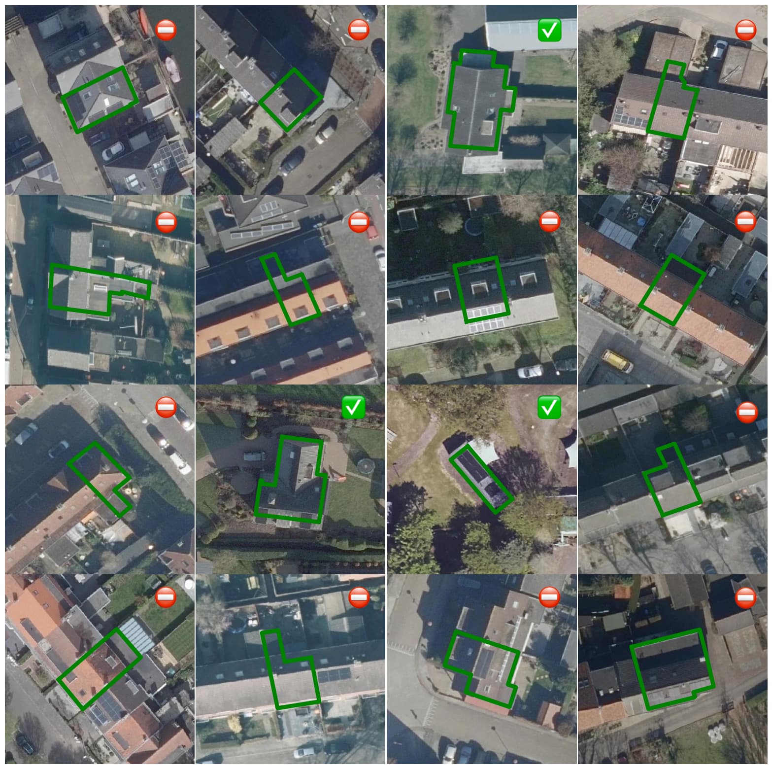
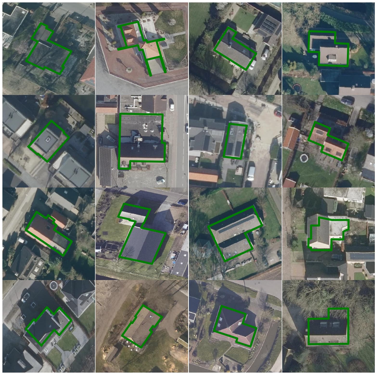
How do I extract building footprints for “complete” buildings?
I notice some polygons are sharing walls with other buildings, at times you even have polygons which seem to map to an apartment of the apartment building instead of the full building footprint.
Can anyone assist me with the matter?
I’ve downloaded the full BAG and the 3DBAG datasets with no luck so far. For filtering purposes for now, I’ve done the following:
The answer is in the matter how you define ‘building’. If I understand your question you only looking for detached houses. But in the BAG every house is his own building if its attached to the ground. The filter ‘aantal verblijfsobjecten’ says something about the amount of useable/rentable spaces is the building. An appartment building (‘flat-gebouw’ in dutch) is one building but contains multiple appartments which are seperate homes, officespaces, etc.
For the right result you need to do a spatial analysis on the polygons which contains the verblijfsobjecten you want.
From what I understand: if you are looking for detached houses only. Dutch Kadaster provides a “woningtype” (Building type) enumeration. The value for “detached” is “vrijstaand”. This is a commercial dataset.
Alternatively, you can use the Open Source project NLExtract where we do exactly that spatial analysis, and more in SQL to derive an enriched address set. With Building id and “woningtype” per unique address. But for this you first need to read the entire BAG into PostGIS (also with NLExtract).
With spatial queries, finding “Detached,” is maybe the easiest, together with “Verblijfsobjecten” analysis (see above), as e.g. a big appartement/skyscraper building will also come out as “detached”.
Lastly, the result of the above SQL script can be obtained at a reasonable price as a CSV (10 Million Addresses) with which you could join to get all detached (woningtype=vrijstaand) from geotoko.nl. This also supports the NLExtract project.
Wow @Just_OSGeo, thank you so much for the comprehensive answer.
I’ll actively look into the NLExtract.
By chance, since you seem quite knowledgeable - I’ve seem to have found the data (almost) with TOPNL, are you aware of any link there may be between TOPNL and the BAG dataset?
I’d imagine TOPNL would be a superset of BAG (The Gebouw layer)
I’m actively trying to figure this out with spatial analysis too - My usecase dictates data on a large scale however, and manual ground truth is very time consuming to gather.
Therefore I’m trying to figure out if there’s a way to traverse this data more efficiently.
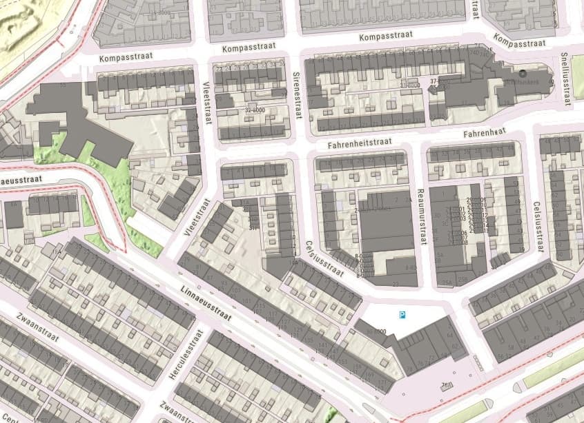
@geomapper Thanks! Yes, I am aware of TOP10NL (part of BRT) and even BGT (Large Scale Topography). For authoritative data the BAG is a better source, with daily mutations. TOP10NL has longer release cycles, like every 3 months, plus the buildings not always match up with BAG, many are from a precursor dataset TOP10vector and generalised and even combined in geometries, e.g. houses in a row. See image (TOP10NL Buildings in dark, overlayed on BAG in lightbrown)
Spatial analysis in this case may be as simple as a spatial query on a BAG PostGIS database joining with other BAG tables, mainly VBOs. There are folks here more specialized than me, but PostGIS has all kinds of functions, like Overlaps etc. Maybe adding a Buffer around each building that contains the amount of space from which you consider it “Detached”, not overlapping other buildings, together with having like one VBO and having a ‘woonfunctie’, you will get most of the detached houses.
I agree it may not be perfect, but if utilized together with the BAG you can get pretty close to only having polygons surrounding full buildings (for instance, townhouses if sharing a wall, or apartment blocks etc), given you could for every TOPNL polygon merge N BAG polygons that form the building.
I made another thread in order to not digress too much on this thread, but I’d like to avoid spatial joins if possible - Ideally there must be some IDs linking BAGs with TOPNL, don’t you think?
I bought the NLExtract dataset as recommended by @Just_OSGeo and I can confirm by qualitative random sampling, it will get you very close towards a perfect solution when looking to identify Detached Houses.