Hello all,
anyone knows where to get polygon of public park in Utrecht, the Hague, and Rotterdam? just like this PARKPLANTSOENGROEN in Amsterdam:
I don’t think there is an ‘official’ source for these data.
You could get the data from OpenStreetMap, although it might be incomplete or not accurate.
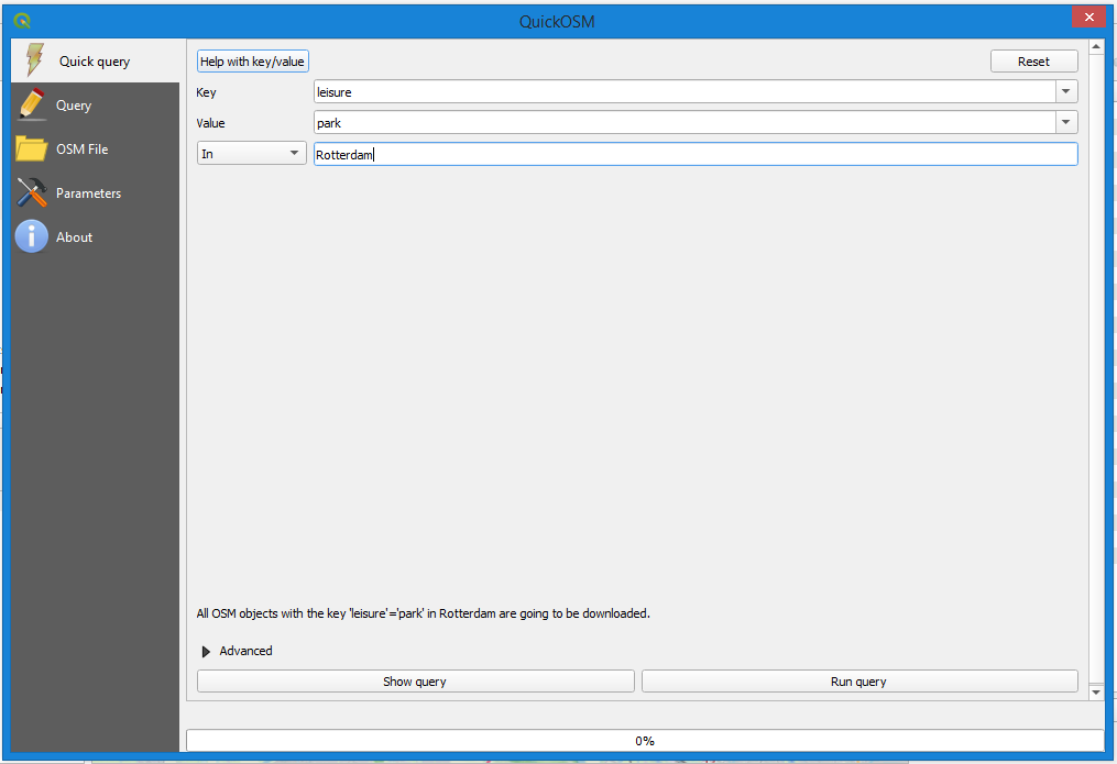
The easiest way is probably to use QGIS. Install the QuickOSM plugin. Create a query. Filter on key = leisure, Value = park and a specific area, for instance Rotterdam. After you execute the query, the data is added to your QGIS project. You can now easily export it, for instance as a GeoJSON file.
Alternatively you could also use Overpass Turbo to query OSM using the Overpass API: https://overpass-turbo.eu/
1 like
thanks for the tips.
actually, i need polygon of public parks with description describe which polygon correspond to what park name. So, i need the official dataset from government source just like PARKPLANTSOENGROEN i got from data.amsterdam