I have a question regarding the dataset located at “GWSW Apps”. I attempted to export the dataset from Geopack format to a shapefile in QGIS, but encountered the following error:
“Export to vector file failed.
Error: Feature write errors:
Feature creation error (OGR error: Coordinates with non-finite values are not allowed).”
I was wondering if you could provide some guidance on how to resolve this issue. Is there a specific workaround or step I should follow to successfully export the dataset?
Furthermore, upon examining the dataset, I noticed that there is no elevation information available for the manholes and pipelines. Could you please confirm if this lack of elevation data is intentional or if there is a separate resource or method to obtain this information?
Thank you in advance for your assistance. I look forward to your response.
Regards,
Maryam
Haven’t looked at the data very thoroughly, nor at the datamodel. So why there is no elevation available, I couldn’t tell you. You probably have to ask the people behind GWSW, unless one of them is active here.
Exporting that Leusden datset to shapefile shouldn’t be a problem though, if I test that using QGis 3.28.4 it exports just fine without errors. Which version are you using? On which of the layers in that geopackage does it give you the error?
And why would you want to export to shapefile? a geopackage is much more convenient, in my opinion. And does not have the limitations that a shapefile has, so I’m just curious
Thank you for responding!
You’re correct—I need to ask themselves about elevations.
The version of QGIS I’m using is 3.30.2-'s-Hertogenbosch.
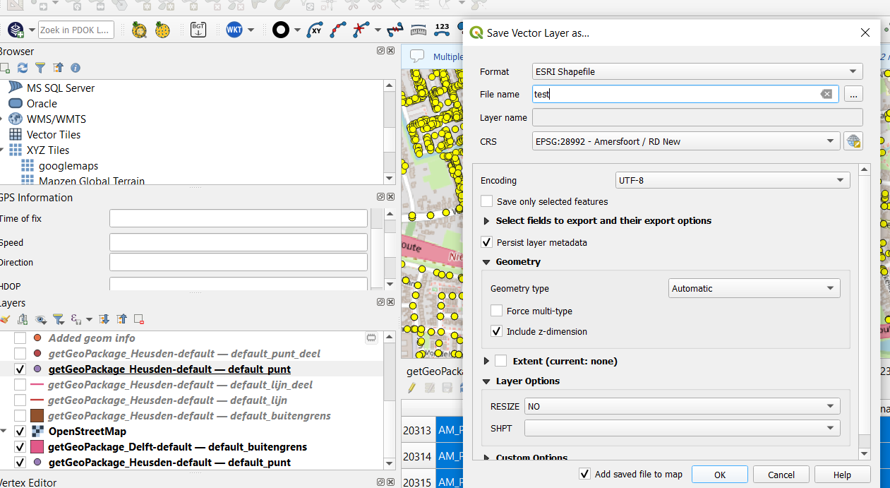
My intention was to export the Punt layer. Here is an image of it:
I need the shape file for another application on a cloud, along with the coordinates of the points.
I find ARCGIS more user-friendly, and QGIS is not as convenient for me .
As far as I know, even ArcGis should be able to handle geopackages these days, but I’m not to sure about that - I don’t (want to) use it.
The strange thing with those points is that they are stored as MultiPoints in that geopackage, even if they are normal, single points. So you need to set the SHPT dropdown to MULTIPOINT - that’s when the errors disappear for me, and the shapefile is created.

 .
.
