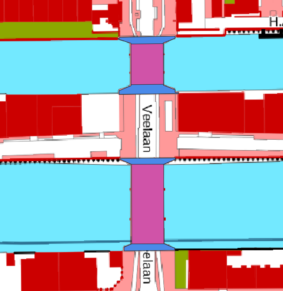
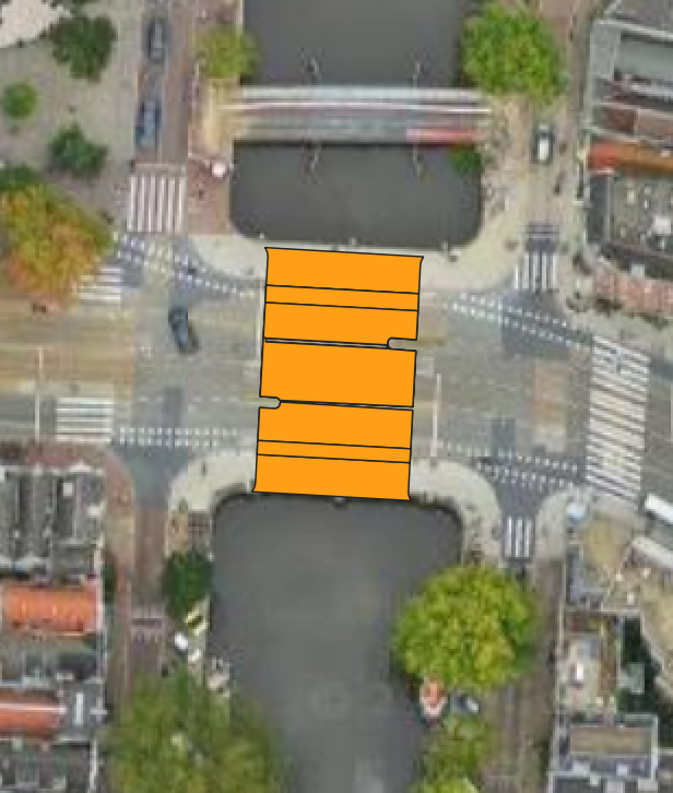
Hello, I am trying to extract bridge geometries from the BGT (for now I am interested in the Amsterdam urban area). I am using the layer named ‘bgt_overbruggingsdeel.gml’ and noticed that there are information about the deck, pillars and abutments. An example of bridge deck in pink and abutments in blue is shown here
Do you know if this information is contained in a different layer in the BGT? If this is not the case, is there any more complete dataset showing in detail the geometries of urban bridges in Amsterdam?
You can try the ‘BGT wegdeel’. It should contain the attribute ‘relatievehoogteligging’ (relativeheight). If the relativeheight is 1 and is intersecting with water (BGT waterdeel), I believe you will get all the bridges.
Hopefully this will work. I didn’t check it out… But worth the try right?
I think that your question has to do with the compulsory part of the BGT vs. the voluntary part of the BGT. Bridge geometries are compulsory. The information about the deck, pillars and abutments are the voluntary part of the BGT.
As information about the deck, pillars and abutments is voluntary you will not find this information on every location in de BGT.
Are you trying to find bridge geometries or deck geometries?
In the first case you maybe best leave the information about the deck, pillars and abutments out of your analyses.
In the second case, i don’t know of a more complete dataset. Maybe someone else??
Since your use case is related to Amsterdam: try the Amsterdam BGT WFS: https://map.data.amsterdam.nl/maps/bgtobjecten
Includes separate feature type for pylon, pillar (BGTPLUS_ODL_pilaar), deck (BGTPLUS_ODL_dek) and abutment (BGTPLUS_ODL_landhoofd).
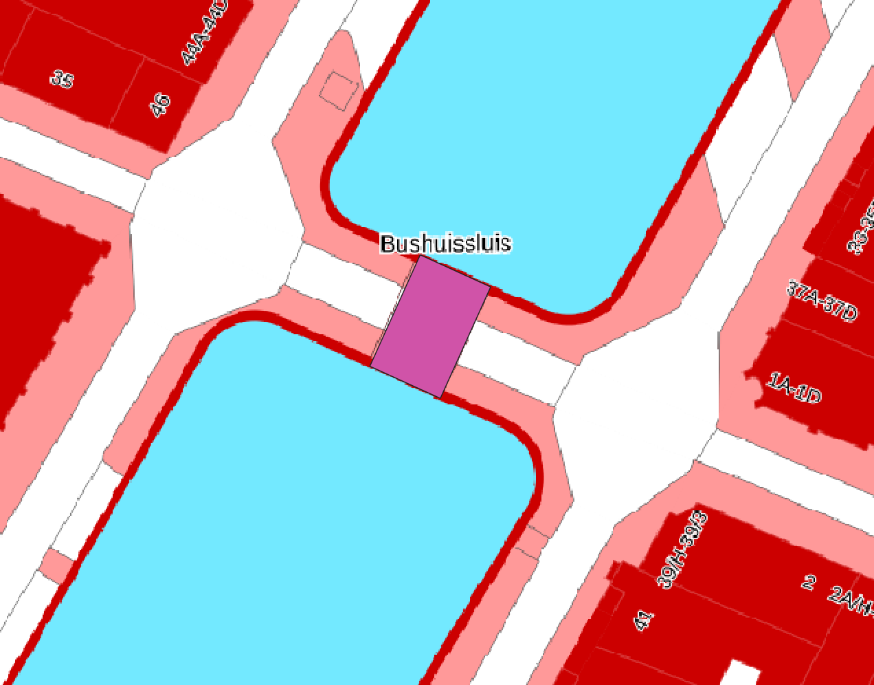
Hi, thanks a lot for your response. I tested the option you mentioned and I am indeed able to identify bridge geometries, but as you can see in the attached example it still doesn’t select the whole geometry and the parts corresponding to the abutments
Thanks for this. I didn’t know that some parts of the BGT are compulsory and others are voluntary. I now understand why the abutments/pillar information is available for some assets only. To respond to your question, I am trying to find the whole geometry of all bridges. Furthermore, information about deck, abutments and pillars would be extremely useful as well. As I showed in the screenshot in the response to Nieksprengers, bridge geometries seem to be often incomplete as the parts of the asset connecting the structure to the main land are missing. Hope this clarifies the question in my previous post.
Thanks a lot for your response @gisnederland. Unfortunately I cannot open the link you shared. I am getting the following message “mapserv(): Web application error. Traditional BROWSE mode requires a TEMPLATE in the WEB section, but none was provided.” Do you know what it is asking for?