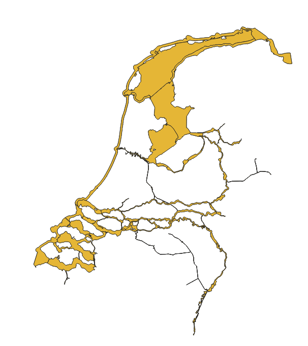
I’m looking for a dataset containing the boundaries of rivers, lakes and the coast of The Netherlands in order to load them into my QGIS map. I need the polygon of the rivers, lakes and the coastlines, in order to solve my problem:
I have my own dataset providing the latitude and longitude of different unique ID’s. Now, I would like to classify those ID’s that are showing on the rivers as ‘on water’ and those that are on land as ‘on land’. There are thousands of data points, so manual classification is not possible.
I could not find the right dataset at nationaalgeoregister.nl, but maybe I overlooked. Does anyone know where I can find the proper dataset?
You could use TOP10NL (part of the ‘Basisregistratie Topografie’ in which you could select all polygons of class ‘Waterdeel’. It contains all water wider than 6 meters. Water smaller (thinner?) than 6 meters is represented as lines.
Another options might be to use the BGT (Basisregistratie Grootschalige Topografie).
Thank you both for your suggestions. The WFS (dataset with larger waterbodies) is exactly the type of information that I need, but it does not contain the information for the smaller rivers/lakes. Therefore, I’m afraid it is not useful.
The problem with the other option, TOP10NL, is that it seems that it can only be used for direct visualization on the map as provided by Nationaalgeoregister and that it cannot be downloaded. Also, I’m not sure if it’s possible to merge the three different layers ‘waterdeel_vlak’, ‘waterdeel_lijn’, and ‘waterdeelvlak_countour’. How can I download the information in a file?
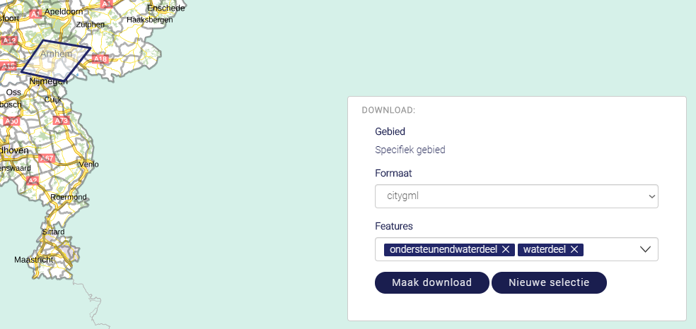
You are probably only interested in the waterdeel and ondersteunend waterdeel features.
These can be selected in the features dropdown. To create a download link click on ‘Maak download’.
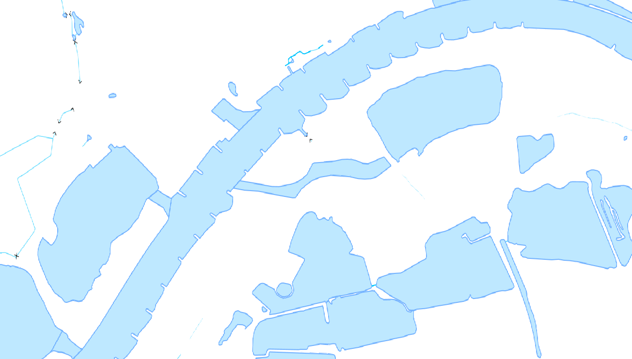
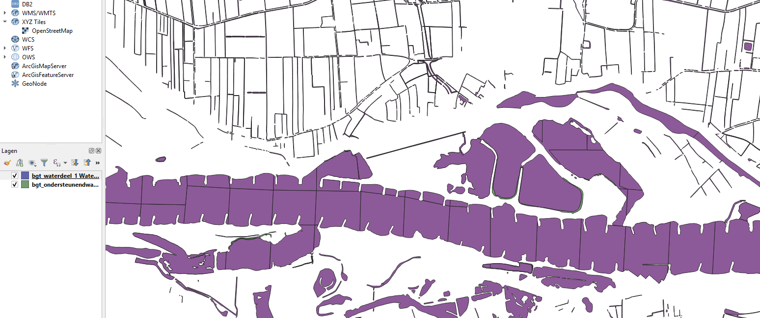
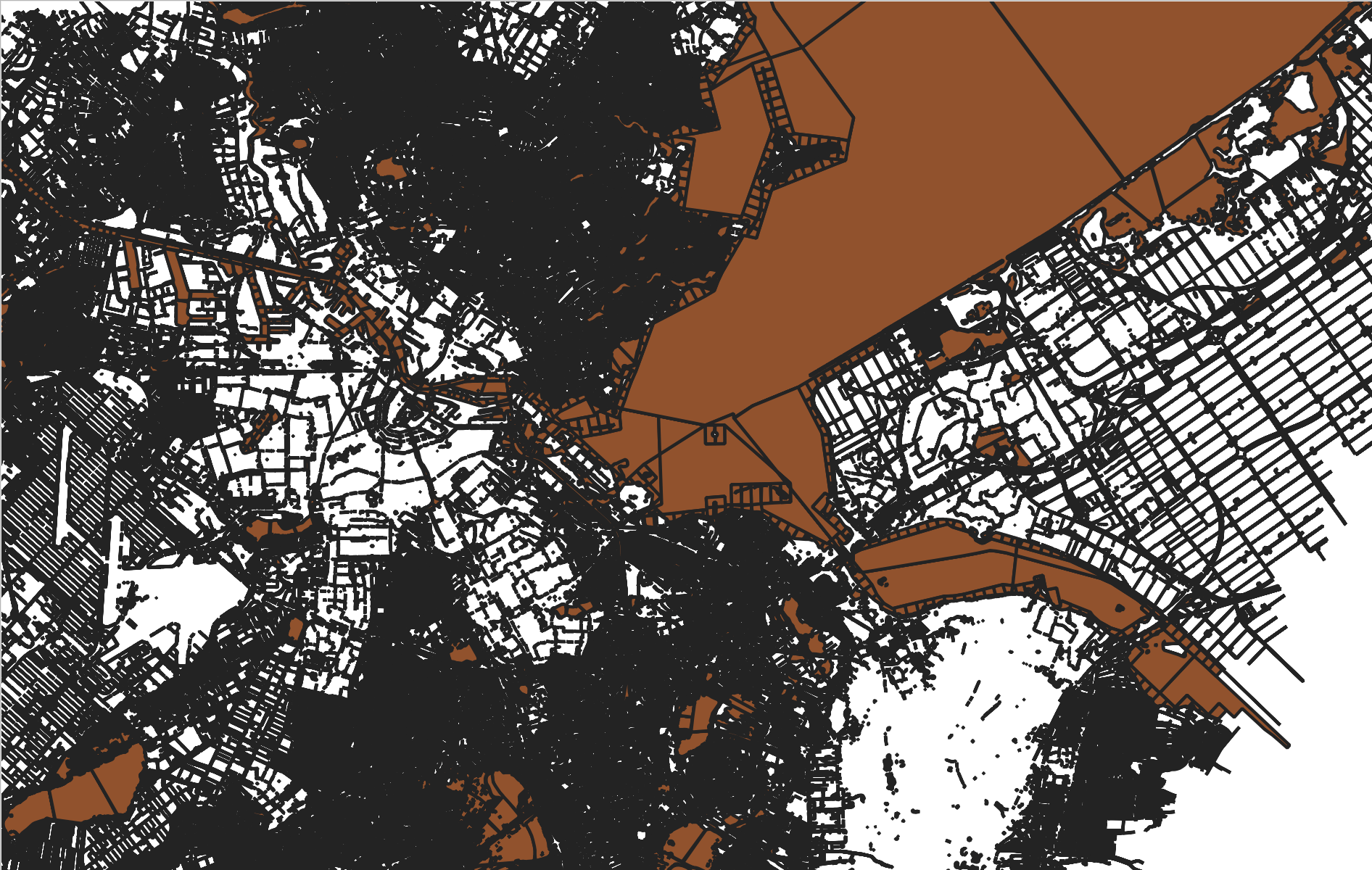
Thank you very much for your responses again. I downloaded the data via https://download.pdok.io/lv/bgt/viewer/ containing the 'waterdeel and ‘ondersteunendwaterdeel’. However, I’m still missing the data for the small water areas. These areas are probably too small to be considered as ‘waterdeel’ I guess. For example, the canals of Amsterdam are not registered as water. Please see my screenshot. How can I get these smaller water areas into my map in order to classify the information of my own dataset as “on water”?.
There is also a dataset with all the waterways in the Netherlands. It is called the “NWB-Vaarwegen”. This dataset contains alle the navigable waterways in the Netherlands for proffesional and recreative shipping. with a minimal higt of 2,45 meter and a minimal depth of 1,10 meter. You can find a WFS and WMS and a download on this page:
There is also a dataset called DTB (suggestion from @Herzo, representative of the data) in which you can find data that might be interesting. This dataset is available via PDOK (downloads and webservices):